Antique maps and modern navigational charts are in demand! We offer a wide range of maps - from the Colonial Period to the Civil War to the modern age. Other cities are also available! All maps are high quality reproductions and are available in a variety of sizes on paper or canvas.
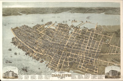
One of the most popular maps of Charleston, this panorama has amazing detail and a legend to identify important places in our historic city.
18" x 24" on paper: $45.00 18" x 24" on Sticky Art: $55.00 18" x 24" on canvas (gallery wrap): $140.00
Custom sizes available.
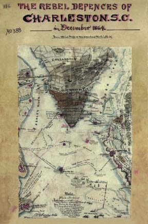
This map shows the burned section of Charleston as well as the defensive positions of the Confederate Army in 1864.
18"x24" on paper: $45.00 18"x24" on Sticky Art: $55.00 18"x24" gallery wrap canvas: $140.00
Custom sizes available.
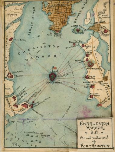
Fort Sumter. The starting point of the Civil War. This map outlines the incredible assault on the massive fort during the war.
18"x24" on paper: $45.00 18"x24" on Sticky Art: $55.00 18"x24" gallery wrap canvas: $140.00
Custom sizes available.
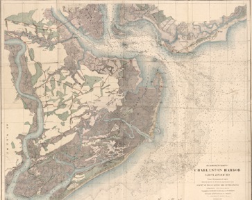
This early navigational chart is popular for its colors and great detail. The quality of this map makes it a great addition to your collection.